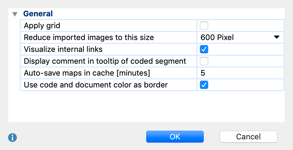
By clicking on the ![]() Options symbol in the top right corner of the MAXMaps window, a dialog will open where you can view and change standard settings.
Options symbol in the top right corner of the MAXMaps window, a dialog will open where you can view and change standard settings.

Apply grid – this option “snaps” your objects to a grid, which is visualized in the background. This allows you to more easily line up objects in straight lines, and the grid will not be shown in exported pictures.
Reduce imported images to this size – this setting determines how imported images are handled. You can select "300px", "600px" (= standard), "1,200px" or “Original size”. The longest side of an imported picture is then reduced to the maximum pixel size. Background pictures are always imported in their original size.
Visualize internal links – when this box is checked, internal links are visualized by a blue line between documents, as soon as documents are inserted into a map.
Display comment in tooltip of coded segment - when this box is checked, comments to a coded segment are displayed as tooltips, when you hover the mouse cursor on the coded segment while having the synchro mode activated.
Auto-save maps in cache [minutes] - when this box is checked, a temporary copy of the map is saved to cache at the set interval
Use code and document color as border - Check this option to display code and document symbols with colored borders in their respective code/document color. If this option is unchecked all symbols are displayed with black borders and a small color symbol.
