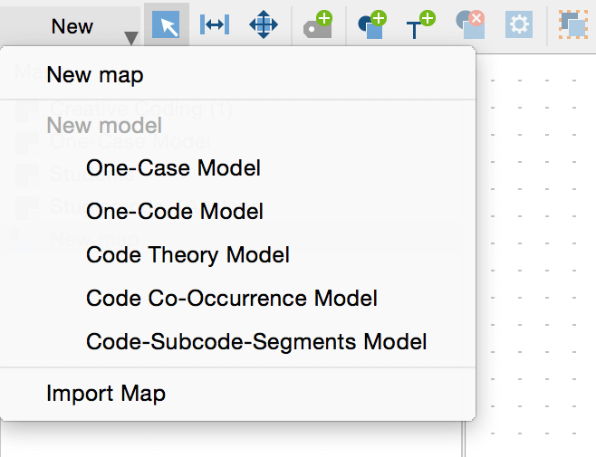
Instead of creating maps manually, you can also choose to use one of the pre-programmed MAXMaps models for the visualization of your research. The models create structured visualizations of various aspects depending on the model. To create a new model open the Map-menu and choose New model.
To learn all about the different models in MAXMaps, you can also watch our respective video tutorial: