 Eared owl (Asio clamator) in the Meandro del Say- Photograph Camilo Castañeda 2020
Environmental studies together with other disciplines such as social, political, legal, and cultural studies have made a change in the construction of new opportunities for evolution in the transformation of societies from a historical context to a real possibility of sustainable development.
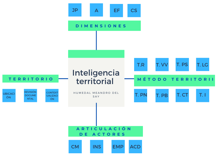
My research project focuses on the Meandro del Say wetland, a place of importance in the metropolitan region located in Colombia on the limits of Bogotá Capital District, Fontibón and the municipality of Mosquera Cundinamarca Vereda San Francisco. Its main problem is the disjointed nature of actors that prevents an effective process providing for environmental protection of the ecosystem and its surroundings. For this reason, the general objective was to make a proposal with sustainable alternatives for the territory according to the territorial intelligence that corresponds to the dreamed territory, by means of the territorii method and its 8 categories (Real Territories -TR, Lived Territories -T. VV, Past Territories – T.PS, Legal Territories – T.LG, Thought Territories – T.PN, Possible Territories – T.PB, Concerted Territories – T.CT and Intelligent Territories – T.I). The study of these categories allows us to identify the main social actors (Community – CM, Institutional – INS, Entrepreneurial – EMP and Academic – ACD) that are involved in transformation actions that lead to the development of descriptive historical, perspective, propositive, and intelligent reports (Bozzano, H.). Likewise, the territorial dimensions are taken into account (Juridical-Political – JP, Environmental – A, Physical Space – FS and Social Construction – CS), providing a construction of an environmental rationality, (Bustos 2015) identifying the transformation in time and space, by knowing the dynamics to determine the dreamed territory from the territorial diversity, creating a strategic alliance in defense of the Meandro del Say wetland according to Territorial Intelligence from now on (TI).
Coding categories with MAXQDA
In keeping with the research approach, the main categories of the Territorial Intelligence territorii method were added as main codes and the territorial dimensions as subcodes; the Social Actors code was added with subcodes classifying them according to the table analogy of the four legs of TI, and memos were established recalling the concept for each code and subcode.
The first analysis was performed with the classification of the main documents; once the codes were organized, the project was continued by coding sections of the document. In this way the MAXQDA software organizes the documents with its different tools. Once the documents were categorized according to the established codes, a code cooccurrence model was created.
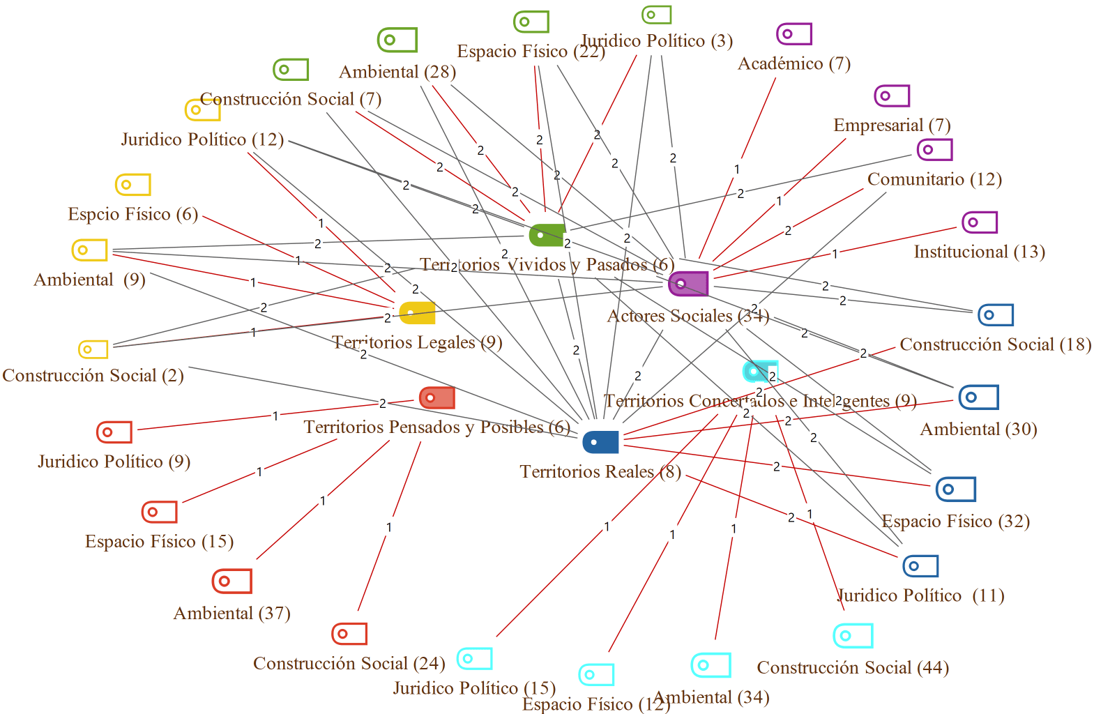 Example of a code co-occurrence model
To obtain this model the following steps were performed, i) in the MAXMaps tab click on new code model ii) code co-occurrence model, then drag the codes that you want to analyze; each time you enter a code the system asks you if you want to insert more, there you can choose the ones of your preference, and finally it automatically shows the co-occurrence graph. There you are free to start modifying it, you can select the layers, modify the colors, if you want to visualize the frequency of codes and the line thickness, it is very versatile which helps your analysis. In addition to this within the codes tab there is a very useful tool- the statistics of the subcodes that helps us to graphically visualize the results of the subcodes.
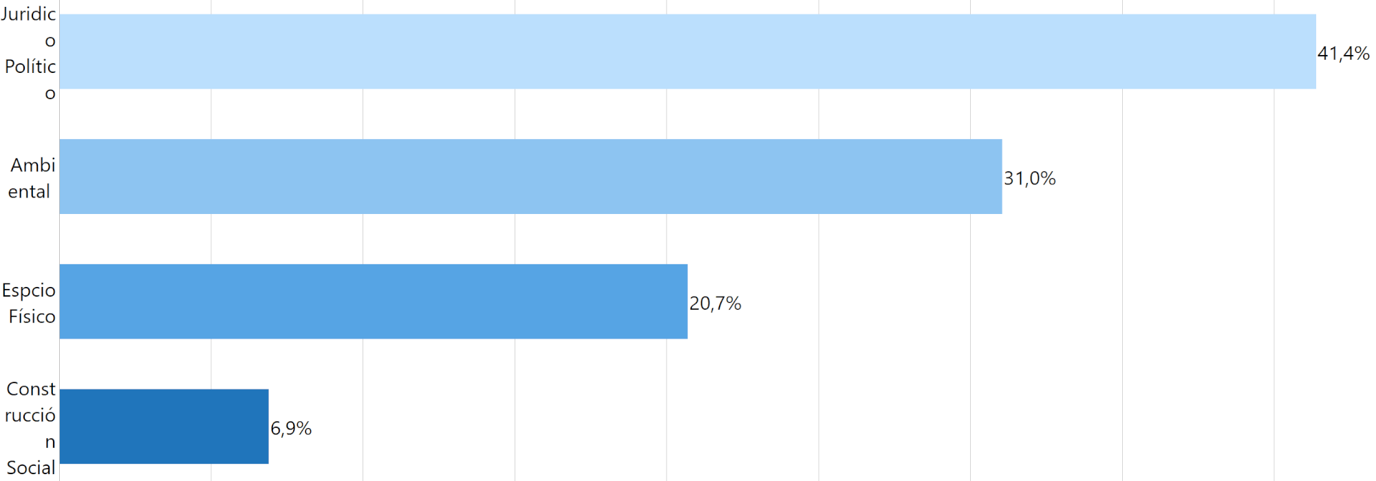 Example of subcodes statistics
For this exercise you enter through the codes tab, go to subcode statistics, select the codes you want to analyze, then click on coded segments and confirm; this process automatically displays a window with the data of the subcodes. You can modify the initial design, displaying only a table or graph with integer values or percentage of each subcode, changing the colors, position, title, and then exporting or printing the results, thus facilitating the analysis of the subcodes.
In my case, I coded the categories of the territorii method crossed with the territorial dimensions worked on, which was a great help when analyzing the elements of my project, since I could then obtain automatic graphs to export for the final reports. Combined with the data of each subcode, this can be used for later exercises or to start the process to guide the most viable alternatives in the territory.
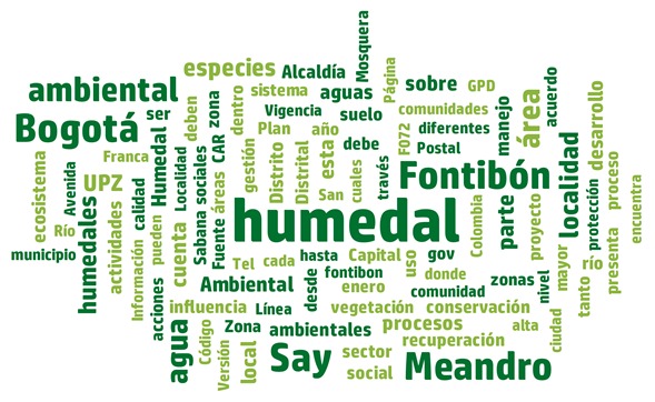
Also, the word cloud tool was used, which allows you to insert the documents of your interest, and then graphically displays the most representative words; there you can exclude the words that are not of interest to the research, likewise modifying the design, selecting the minimum frequency, reorganizing, and finally copying or exporting the image. Leaving the mouse over a word will show the number of times it occurs, and clicking opens a window with the search results, showing in which paragraphs the word is found and the name of the document.
Some people use this tool to start coding: in my case, as I already had the categories defined, I used it to start creating my research instruments relating them to the codes already established, continuing the research, such as the guiding questions to a semi-structured interview and focus group work that I will continue to analyze later with the MAXQDA software tools, with the purpose of advancing with my objective of articulating social actors to strengthen the defense, protection, and conservation of the Meandro del Say wetland, proposing alternatives for microtransformations that lead to the territorial sustainability of the study area.
References
- Bozzano, H. (2011). Inteligencia territorial, actores y transformación. In 1ère Conférence Intercontinentale d’Intelligence Territoriale” Interdisciplinarité dans l’aménagement et développement des territoires”
- Bustos Velazco, E. H. (2015). Investigative trends in territory and its importance in the formation of professionals
About the Author
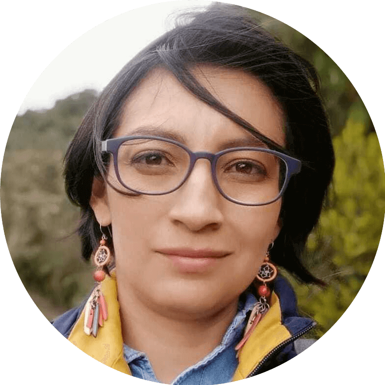
Leydi Diana Usaquín Ruiz is an Environmental Engineer with specialization in environmental education, and currently a research student of the Master’s Degree in Sustainable Development and Environmental Management at the Universidad Distrital Francisco José de Caldas, Bogotá – Colombia, and the co-founder of the Fundación Territorio Ambiental & Social.

 Leydi Diana Usaquín Ruiz is an Environmental Engineer with specialization in environmental education, and currently a research student of the Master’s Degree in Sustainable Development and Environmental Management at the Universidad Distrital Francisco José de Caldas, Bogotá – Colombia, and the co-founder of the Fundación Territorio Ambiental & Social.